Rock Team
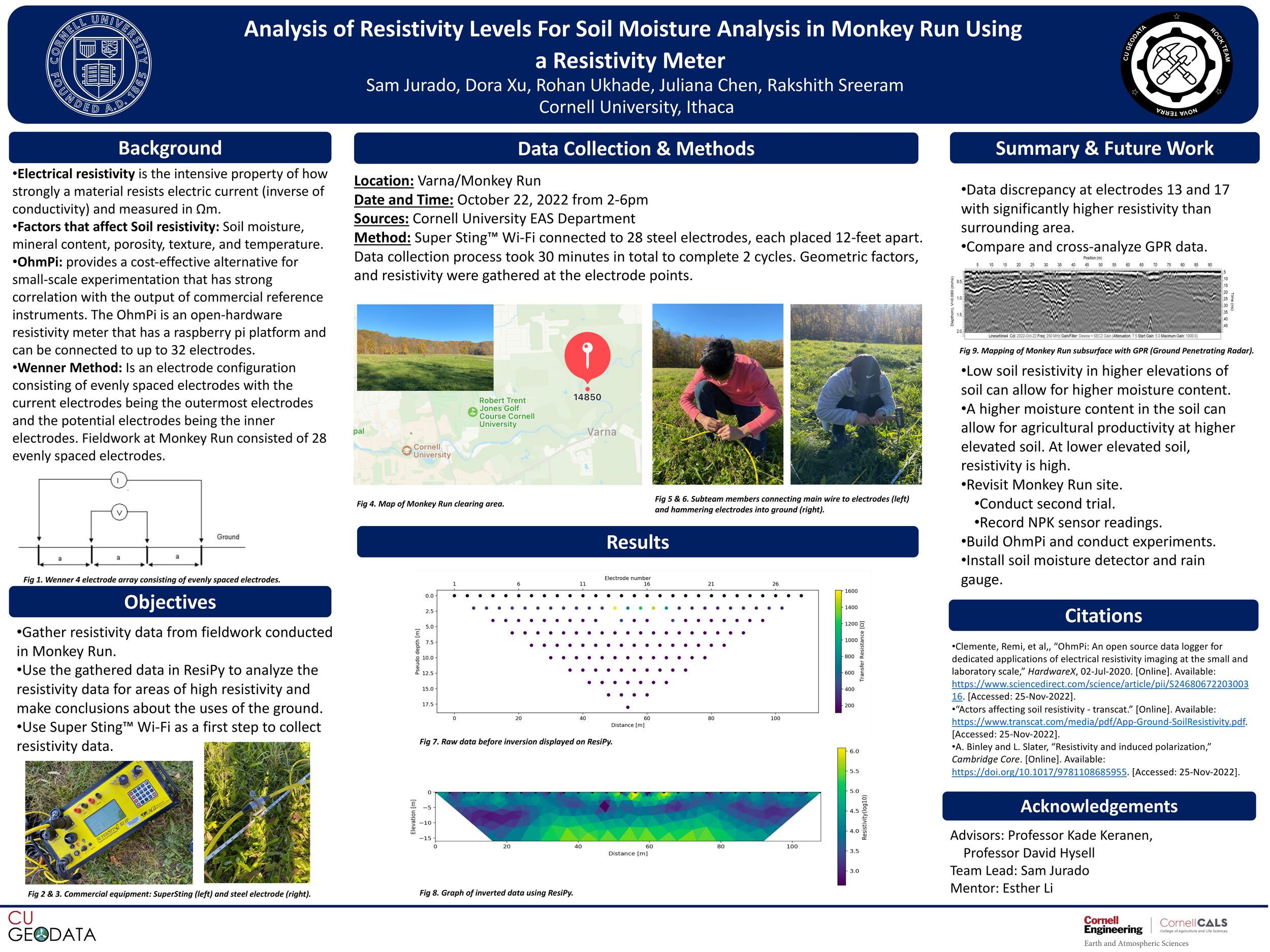
The Rock sub-team conducting fieldwork in Monkey Run (Varna) using the SuperSting resistivity meter and Ground Penetrating Radar (GPR) under Dr. Keranen’s guidance.
Rock Team
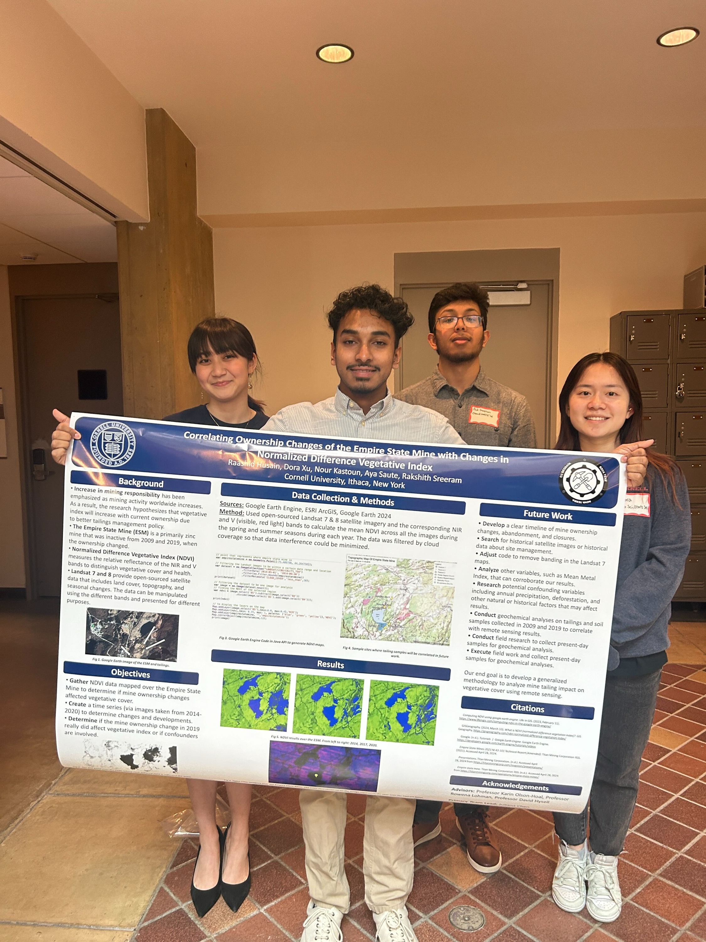
The rock team is responsible for measuring and monitoring the quality and stability of soil and earth minerals in our region. Microorganism biodiversity, erosion resistance, agricultural/vegetative productivity, and conservation of the water table highly depend on soil composition. The Rock Sub Team is currently responsible for developing a method to correlate ground truth measurements surrounding the Empire State Mine to satellite imagery derived from Google Earth Engine. In Google Earth Engine, the team aims to utilize open-sourced imagery from Landsat, Sentinel, and other satellite imagery to measure and map the vegetative index surrounding the Empire State Mine. Read more below!

Current Project
During Spring 2025, the Rock subteam plans to enter the lab to process mine tailing samples from 2009 and 2019. Through acid leaching of samples, we will determine mineral and heavy metal concentrations, which will help us understand how mine activity differs between ownership and usage changes. In addition to lab work, Rock subteam members will each make a map or time series in Google Earth Engine to demonstrate how changes in ownership and mine usage impacted the local environment.
Breaking Ground
Rock team currently utilizes a range of state-of-the-art instruments to explore Ithaca’s subsurface. With GPR and resistivity sensors, Rock team works to find the avenues by which contaminants permeate the soil and enter the watershed.
-
![]()
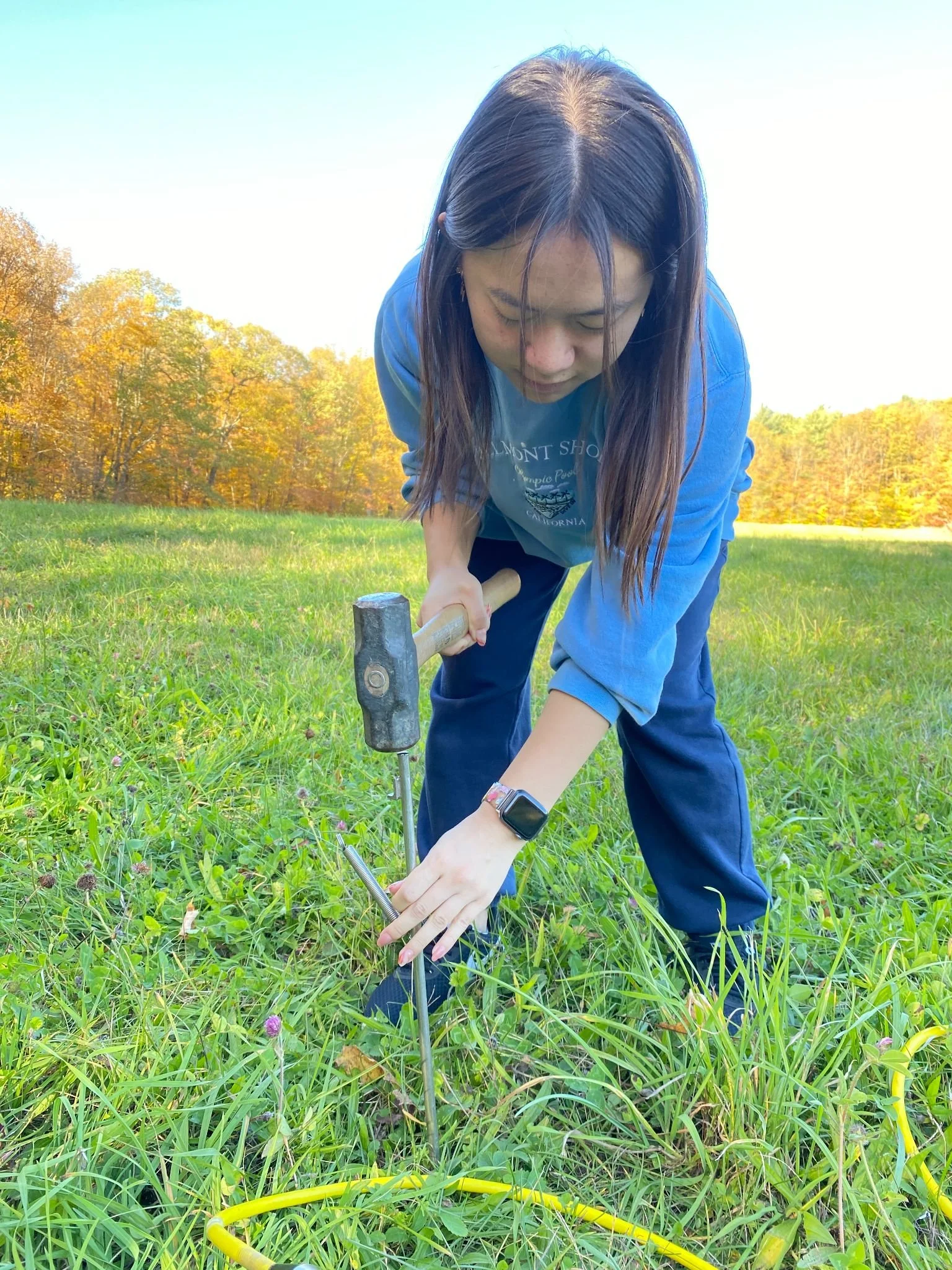
Rock subteam member, Dora, hammering in one of 28 electrodes to set up equipment for collecting soil resistivity data in the Monkey Run area.
-
![]()
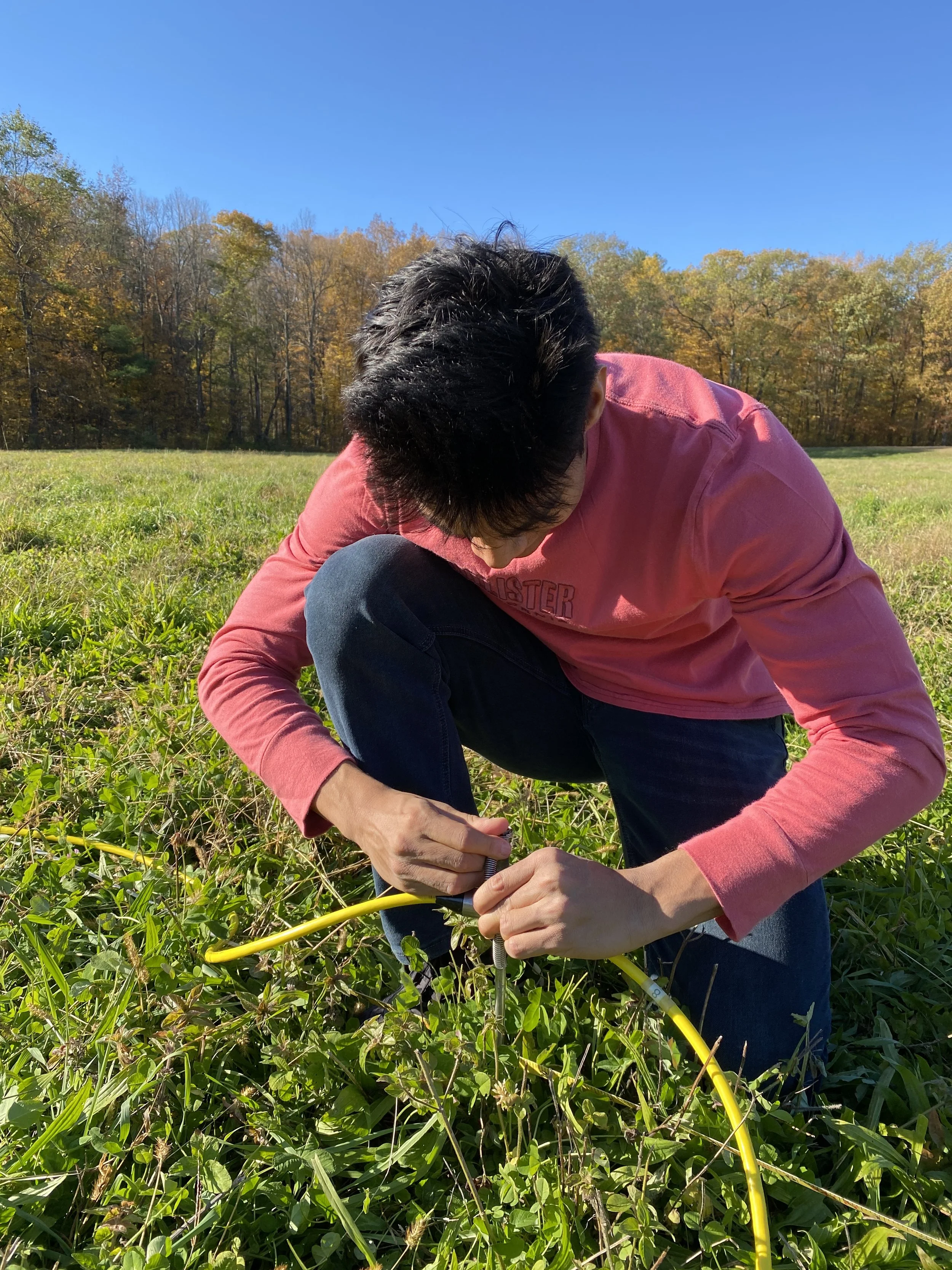
Rock subteam member, Rohan, connecting the electrodes to the main cable to complete the 28 electrode array.
-
![]()
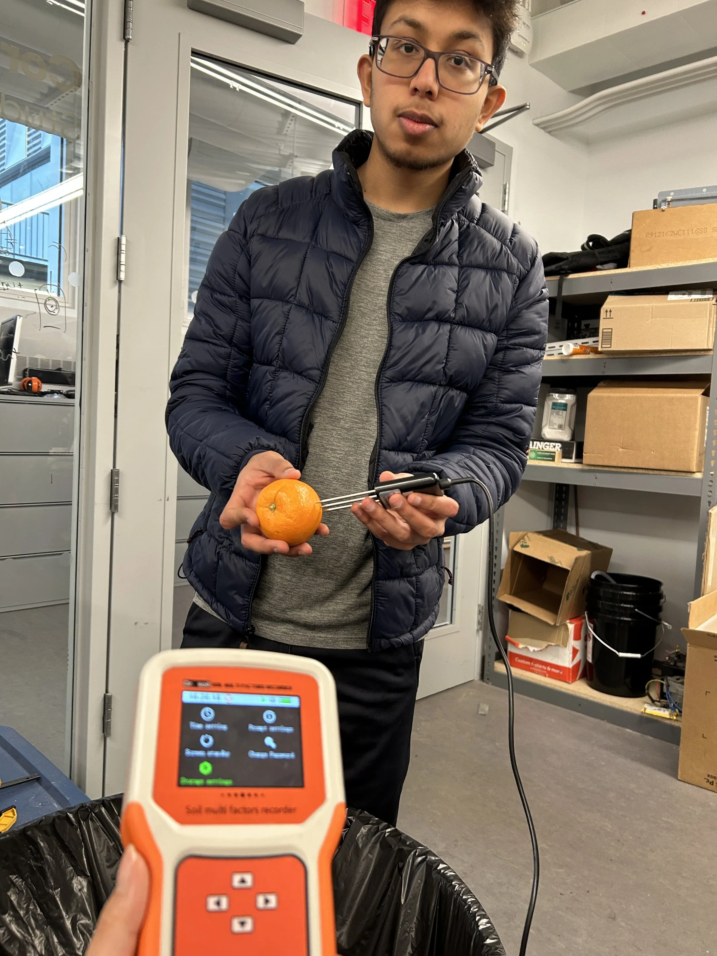
The rock subteam conducting tests with the NPK sensor with different fruits to observe fluctuations in NPK levels.
-
![]()
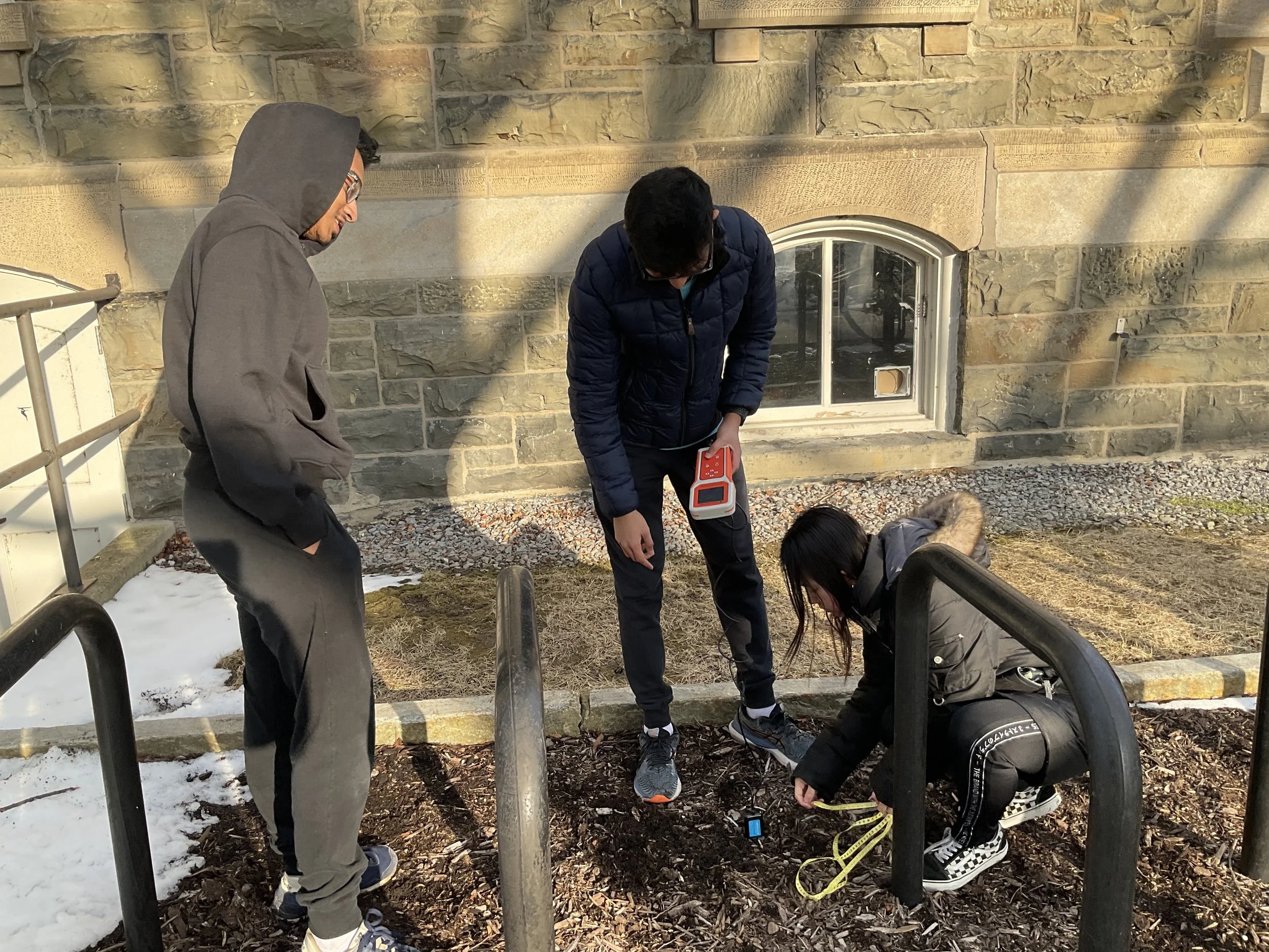
The rock subteam collecting data with the NPK sensor on the Arts Quad. By testing instrumentation, the team aims to increase data collection accuracy.